


Gallery
Data portals using GeoNetwork
The product documentation contains a list of portals which are based on GeoNetwork.
The list is available at https://docs.geonetwork-opensource.org/latest/annexes/gallery/
GeoNetwork screenshots
This paragraph lists a visual representation of some of the main functionalities of GeoNetwork.
Search

Find & Get information
Map Viewer

Make your maps
New record

Create a new record
The Editor
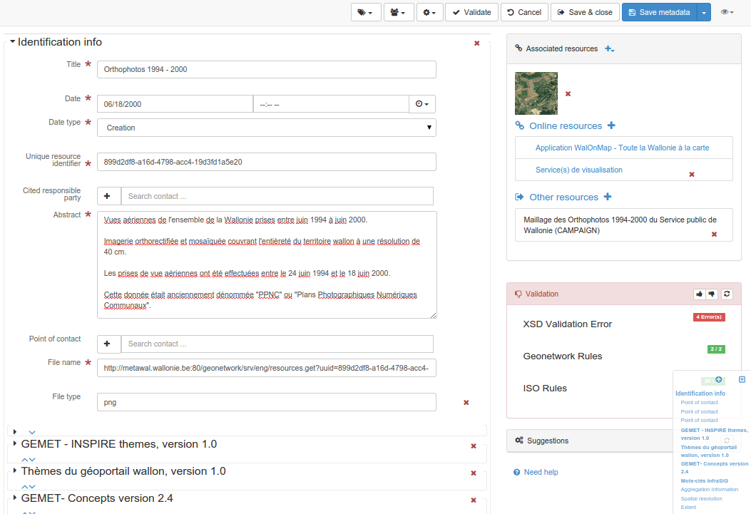
Publish and describe resources