


GeoNetwork is a catalog application to share information for search and discovery. Contents are managed with a full set metadata editing and review tools backed by a publication workflow.
Built with love by the geopatial community, GeoNework has deep support for spatial information and includes an interactive web map viewer. GeoNetwork is a vital component of numerous Spatial Data Infrastructure initiatives world wide.
Find & retrieve information
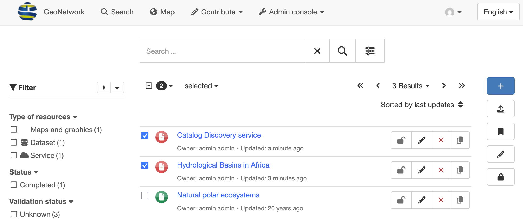
GeoNetwork provides an easy to use web interface to search geospatial data across multiple catalogs.
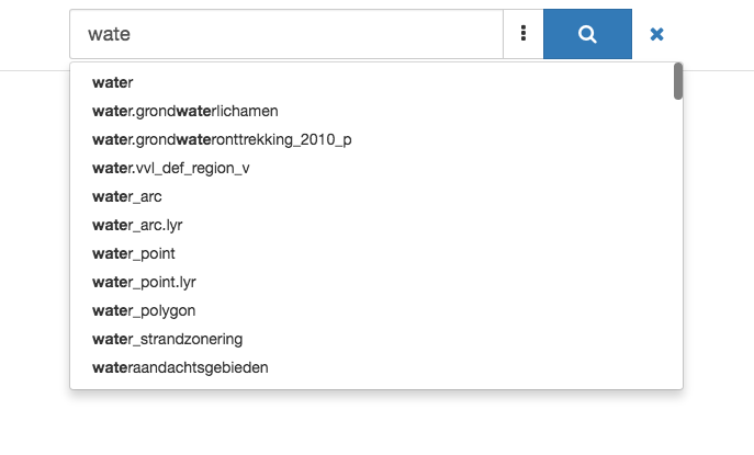
The search provides full-text search as well as faceted search on keywords, resource types, organizations, scale, and more. Users can easily refine the search and quickly locate their records of interest.
GeoNetwork is a general purpose catalog for sharing information. Easily navigate accross records and find sources, or services, publishing a dataset.
GeoNetwork is built with love by the geospatial community with special attention to geographic datasets, layers, services, and maps.
Make your maps
Using the GeoNework catalog visitors can easily find new services, layers and produce dynamic maps combining information from multiple services.
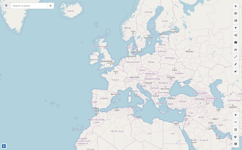
The OpenLayers interactive map viewer provides access to open OGC services (WMS, WMTS), and REST services (Feature Service, MapService), along with standards formats (KML, OWS).
User maps can be annotated and printed and shared with others.
Describe resources
Describe information using the online metadata editing tools. The metadata editor support Dublin Core format used by opendata portals, and geospatial data and services with ISO-19115, service categories with ISO-19119, and data categories with ISO-19110 standards.
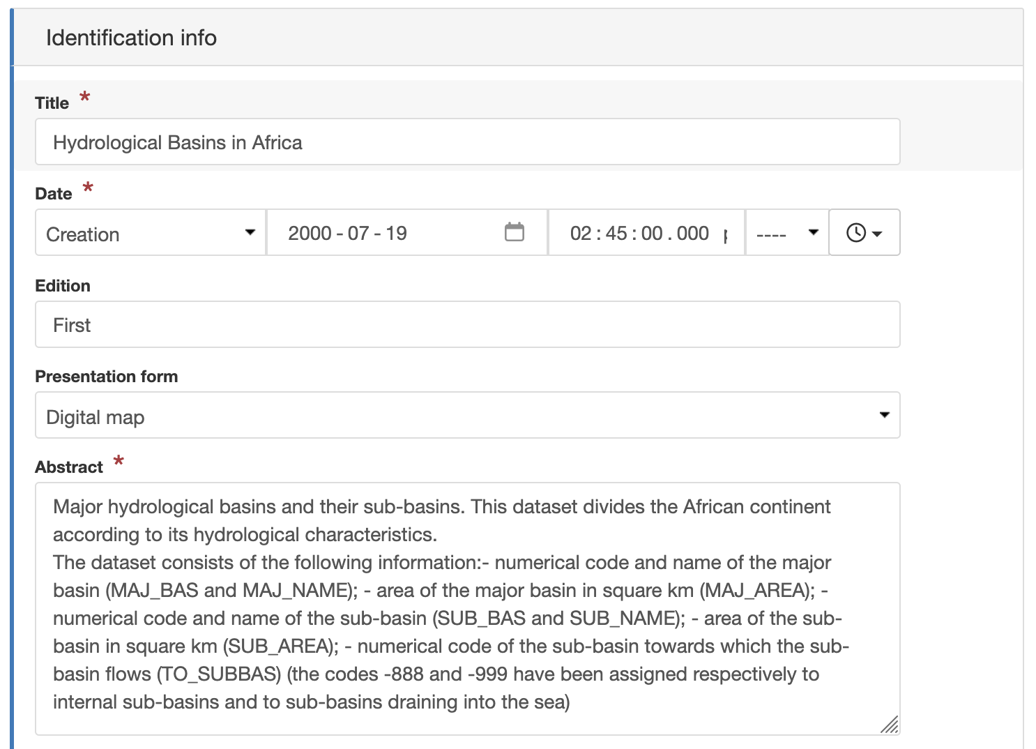
Online editing of records is based on a powerful template system, information lookup (eg. contacts), and authoritative definitions (eg. thesaurus).
The editor allows records to store uploaded data, including graphics, documents, pdf files and any other content type. It supports among others:
multilingual metadata editing
validation system
suggestion to improve metadata quality
geopublication of layers to publish geodata layers in OGC services (eg. GeoServer)
Publish resources
Carefully manage the publication of information, using permissions share records with different groups. GeoNetwork supports multiple portals, allowing each group their own browsable catalog and web services.
The Editor dashboard provides easy access to information and tasks for reviewers and editors.
The full publication workflow allows changes to be reviewed and approved prior to publication.
Easy configuration
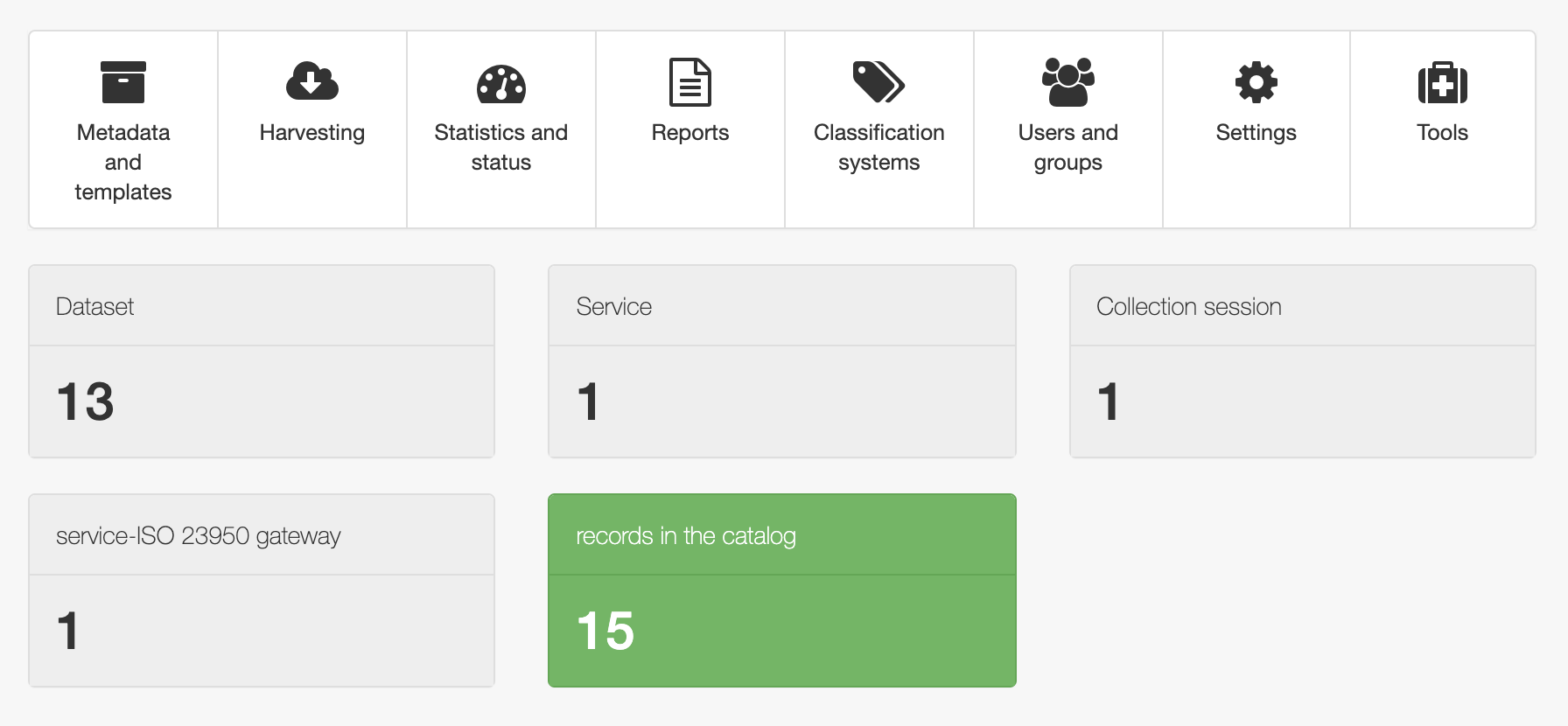
The administration console provides quick access to the system configuration. Easily manage user and group accounts, classification systems from the web interface
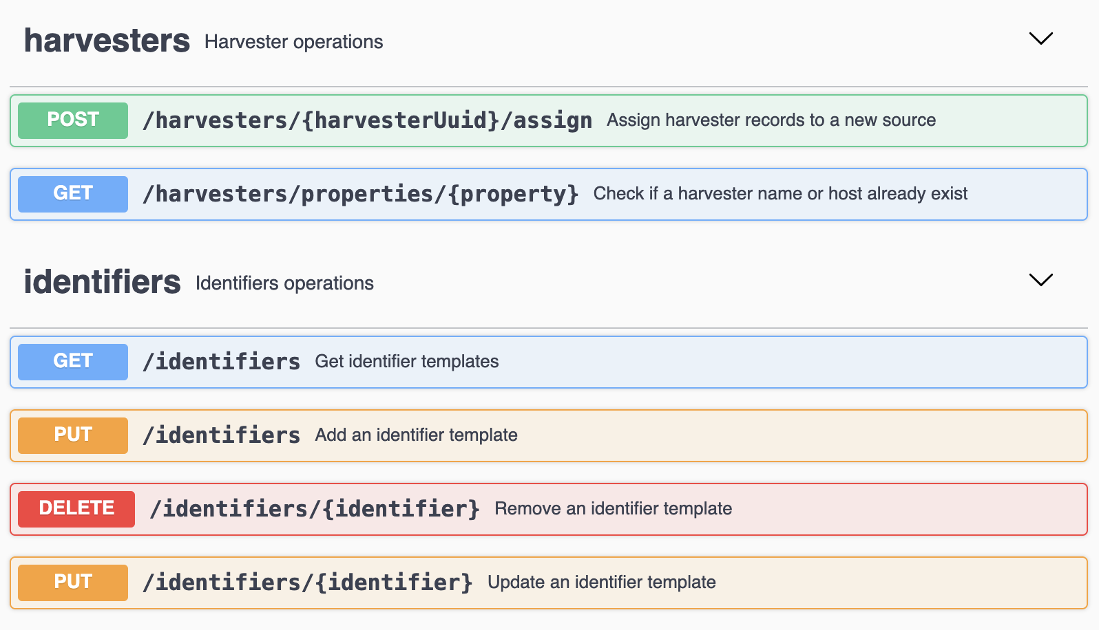
Schedule metadata harvesting to synchronize records from many sources including:
OGC-CSW 2.0.2 ISO Profile
OGC WFS
OAI-PMH
Thredds
SFTP and WebDAV
Web Accessible Folders
GeoPortal REST and ArcSDE
Other GeoNetwork catalogs
Monitoring and reporting tools provide administrators insight into catalog contents and statistics on the search use. System maintainer can easily access the system status.
Customise & extend
GeoNetwork provides a plugin mechanism for creating your own metadata schema (eg. ISO19115-3 plugin). Schemas can be refined to match national and regional requirements, providing validation and feedback directly within the metadata editor.
GeoNetwork offers built-in support to adjust colors and logos used for each portal. Further customise the appearance of GeoNetwork using Bootstrap themes.
GeoNetwork plugins extend the application with optional functionality. The gn-datahub-integration plugin is used to provide a portal with a modern with GeoNetwork-UI web component facade.
Additional plugins are provided for different cloud storage options (S3, CMIS, JCloud) for data directory and attachments.
API & web services
GeoNetwork provides entry points for interacting with the catalog:
Search service for fast and flexible record retrieval
OGC Catalog Service for the Web (CSW) standards compliant search, retrieval, record management.
OGC API Records next generation REST / JSON standards presently under development
GeoNetwork REST API working with GeoNetwork clients and external systems.
OpenSource & open standards
GeoNetwork has been developed to connect spatial information communities and their data using a modern architecture, which is at the same time powerful and low cost, based on the principles of Free and Open Source Software (FOSS) and International and Open Standards for services and protocols from ISO/TC211 and OGC.
Community and OSGeo
GeoNetwork releases are made possible by everyone supporting the project through code contributions, testing, bug reports, fixes and financial sponsorship.
GeoNetwork is part of the Open Source Geospatial Foundation (OSGeo) software foundation, providing software you can trust to be free, open and sustainable.
Community support is provided through documentation website, and online forum.
More: Community
Professional Support
Commercial support is available to help organizations implement, integrate and maintain the software. You can find them in the Service Provider directory on the OSGeo website.